SuperDink @ high water
Level: ca. 350 cfs @ Dinkey Meadows (dreamflows online guestimation), 1,300 cfs @ Dinkey above North Kings
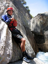
Paddlers: Adam Griffin, Nick Barron, John Webb and Brian Mills
Hikers: all mentioned above
Here's a video from the day, sorry for the shakingness of the shot, Brian was filming.
On our way out from the incredible Tule area in a Food 4 Less parking lot, we decided that with the insuing cold front we could sneak our way onto SuperDink, which had been very high due to an incredible snow pack in the southern Sierras. So we took the gamble and drove straight up the mountain arriving at Dinkey Campgrounds late in the evening.
After pulling into a seemingly empty ranger station, 2 rangers came hiking out of the woods and were curious as to what we were up to. We found that they were not even open yet for the season due to the cold temps and high snowpack, and that they had just cleared all of the roads a week prior to our arrival. The good news that we found out was that the water was way down from previous flows and that though the road to Dinkey Dome was closed, there was a "good" trail up there.
We excitedly pulled into a campsite for free, since no one was around, and planned to begin hiking in as early as possible. A bonus to our campsite, we could practically start hiking from there and then paddle right into camp, ahh the simple life.
Well we awoke early in the morning to the annoying sound of mr. John Webb honking the car horn and screaming, "SuperDink! SuperDink!" Now, John isn't much of a river-beta person, and in fact the only guidebooks he'll "read" are ones with photos, and the best way for him to determine if a river is good or not is to see video of it. With that said, John had seen a clip of Burning Time (Scott Lindgren) with a segment featuring SuperDink. He deemed it "good" and "worth doing" after we told him what it was. At any rate, John was fired up and couldn't wait to start hiking.
Hiking up the "trail" to Dinkey Dome
 Photo Adam Griffin
We had a quick breakfast and began our hike on the "trail" the rangers told us was good to go. Well, we never found a trail that was good to go, actually we never found a trail at all. Just high granite domes covered in Manzenetta (picture rhododendron but sharper, more clustered, and less forgiving) Our only saving grace was the game trails we found snaking thru the masses of hell-bushes.
Hiking up to the base of Dinkey Dome, with Dinkey Dome proper in the background
 Photo Adam Griffin
Finally arriving at the base of Dinkey Dome, a truly awesome sight, we found the water level to be quite high. There's a really neat gorge just downstream of Dinkey Dome that is really tight and locked in. We couldn't see much of it, but from what we could see it didn't look too good and the water was too high. So we hiked back up and over the dome we just hiked our shit up and over and made it to the top of the slide.
A look at the slide from the top
 Photo Adam Griffin
Now, the slide of SuperDink, which gives the run its fame, is an incredible anomaly that is without a doubt the longest slide I've ever run, and is one of the longest slides in the Sierras, somewhere in the 1/4+ mile range. The slide isn't straight forward and does twist thru another gorge before plopping into a pool, and scouting all of it is definetly recommended. But as it was, we were all dog tired and I for one was certainly not fired up about hiking back down to give a scout, to then hike back up. However, Adam said to hell with it and decided to put on despite the high flows. John and I agreed to "set safety" on the cliff above the slide and watch Adam's run, planning to make our decisions based on his sucess/failure. You can see our perch in the last part of the video as we cheer Adam on.
Launching in, Adam said he found the top part very pleasent and had plenty of flow to cover up the scrape. In the first bend of the rapid, however, Adam told me, "That's when it all went wrong and the shit hit the fan." In the video, just as you loose sight of Adam, is where it all went down. The gradient picks up a good bit there and the constriction of the gorge really makes the rapid larger. He made it thru most of the big holes okay, but flew past his planned eddy where he hoped to scout the last few drops, which happen to be the biggest. John and I lost site of Adam and scrambled down the dome to find him stuck in an alcove, right above the last set of drops. Finding that he couldn't get out of the water to scout, I gave him some hand signals describing the lines thru the remaining drops. Peeling out after several attempts to escape the alcove, he crashed down the last bit of the slide and plopped into the pool below and beached himself on the bank.
John and I then got the scoop of the slide from Adam, "There's way to much fucking water in there." Based on that, John, Brian and I promptly picked up our boats and carried around the slide. Our plan then was to run down to camp, but found the water levels still high thru the more boulder garden stuff as I joined Adam in a rather large hole somewhere downstream, executed a marry-go-round in the hole, and then got the hell off the river. We all decided that the water was too high and that hiking would be much better for our health. Instead, the hike out sucked much harder than the hike up and by the time I got to the car, I couldn't move anymore.
That next day we didn't go anywhere or do anything but sat at camp drunk, well fed, and happy. All of this was of course aided by the general store less than 100 yards from our campsite with copious amounts of beer and hot showers. Actually we did paddle thru the campsite section of Dinkey which was fun continous class III, and we still got to have that feeling of taking out at our campsite.
Nick in the campground section of Dinkey Creek

Photo Adam Griffin
posted by nickb @ 11:38 PM
3 comments
![]()

3 Comments:
Great story and nice video of the high water on the Infinislide.
The trail that you could not find starts at the roads end naturally, but instead of following the creek it immediately leaves the creek and goes left up a fire road for a short distance before leaving the fire road. The trail goes over a little pass a quarter or half mile or so to the west of the creek. Once over the pass and into the little valley, the trail still remains a good distance away from the creek. I think the trail only meets the creek at Cow Creek and the base of the Infinislide. You probably got suckered by fisherman trails along the creek that faded out before that first gorge heading upstream
I will update the AW river page to include some information about this trail.
Which brings me to a request. Would you please add comments and photos or video to the SuperDink! AW page and to the other AW pages that probably have even less photos and information?
http://www.americanwhitewater.org/rivers/id/3960
Oh, what were the dates you were on the various runs that you have written about? I did not see that.
Sincerely,
Paul Martzen
Oh, also, the hiking, scouting, and safety is much better and easier on river left along the infinislide section. When you get to the base of the infinislide, paddle across a big pool and start hiking up the south side of the creek (river left).
Paul M.
Hey Paul, I tried to find your email address thru boatertalk and didn't come up with anything, so I figured the best way to get in touch with you is thru here.
Thanks for all of the beta, I'll try to get some of those pictures onto the AW site. Also, the dates that we were out there were from the very end of May thru the middle of July. All the trip reports from CA are in sequencial order. I kept a journal, but was really bad about the dates.
Thanks for checking out the blog, take care
nick
Post a Comment
<< Home